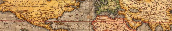
Scramblin' thru... Latitude & Longitude
[Click picture for a larger version.]
Where am I?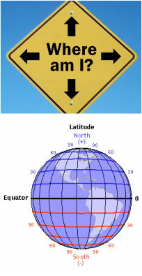
A fairly key geographical question throughout the human experience has been, "Where am I?" The Ancient Greek geographer Ptolemy created a grid system that was transformed into the latitude and longitude system during the Middle Ages (350-1450 AD).
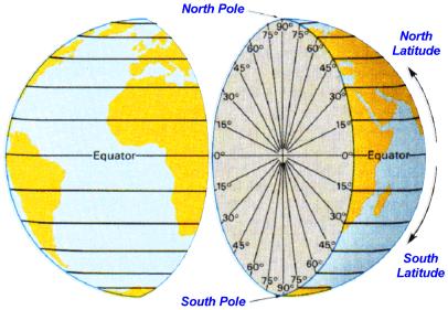
Lines of latitude run horizontally (east-and-west or left-and-right). Latitude lines are also known as parallels since they are parallel and are an equal distance from each other (until you get to the poles). There are 90 degrees of latitude going north from the Equator (0° N/S), the line that divides the planet into the Northern and Southern Hemispheres. The North Pole is at 90°N. There are 90 degrees going south from the Equator. The South Pole is at 90°S. When directional designators are omitted, northern latitudes are given positive values (+) and southern latitudes are given negatives (–). The North Pole is at +90°; the South Pole is at –90°. 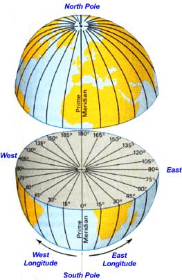
Turn left at Albuquerque...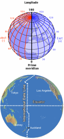
Lines of longitude run vertically (north-and-south or up-and-down). Longitude lines are also called meridians. They meet at the poles and are their widest at the Equator. The earth is divided into 360 degrees of longitude. Zero degrees longitude, called the Prime Meridian, is located at Greenwich, England (0° E/W).
From the Prime Meridian, which divides the earth into Eastern and Western Hemispheres, there are 180 degrees to the east and 180 degrees to the west. When directional designators are omitted, east longitudes are given positive values (+) while west longitudes are given negatives (–). The degrees continue east and west to form the International Date Line, or IDL (180° E/W), in the Pacific. Regions east of the IDL are one day earlier than regions to the west. Although the IDL follows the 180° meridian, it bends around countries to keep from dividing them into two different calendar days. 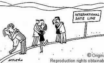
|

While there are many ways to remember which is latitude and which
is longitude (e.g. ladder-tude or longitude is long), Dr. Hartnell has a "fool proof" way of never getting them confused. It is: Latitude-Fatitude. Just picture the earth trying to put on a belt around its big fat belly. Belts run in a left-to-right direction... just like lines of latitude! Brilliant! (Looks like Dr. Hartnell' s MSU degree is being put to good use!) 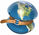

Each degree of latitude and longitude is divided into 60 minutes (60'). Each minute is divided into 60 seconds (60"). Each second can be further broken down.
When writing out a location, latitude is listed first.
Washington, D.C. is located at... 38°53' 23"N, 77°00'27"W, which means it's 38 degrees, 53 minutes, and 23 seconds north of the Equator and 77 degrees, zero minutes, and 27 seconds west of the Prime Meridian. Westerville North High School is located at... 40°07' 55"N, 82°53'52"W. Global Positioning Systems (GPS) like "On-Star" do this via satellites. 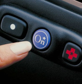

In 1884, at the request of President Chester A. Arthur, 25 nations met in D.C. to adopt a world meridian so all maps could be uniform. The Greenwich Meridian was chosen as the "Prime" Meridian because, at that time, two-thirds of maps were already using it as such. (Because it was not through their country, France didn't adopt the Greenwich line until 1911. Annnd that's why no one likes them.)

President Cleveland knows what's up...
|